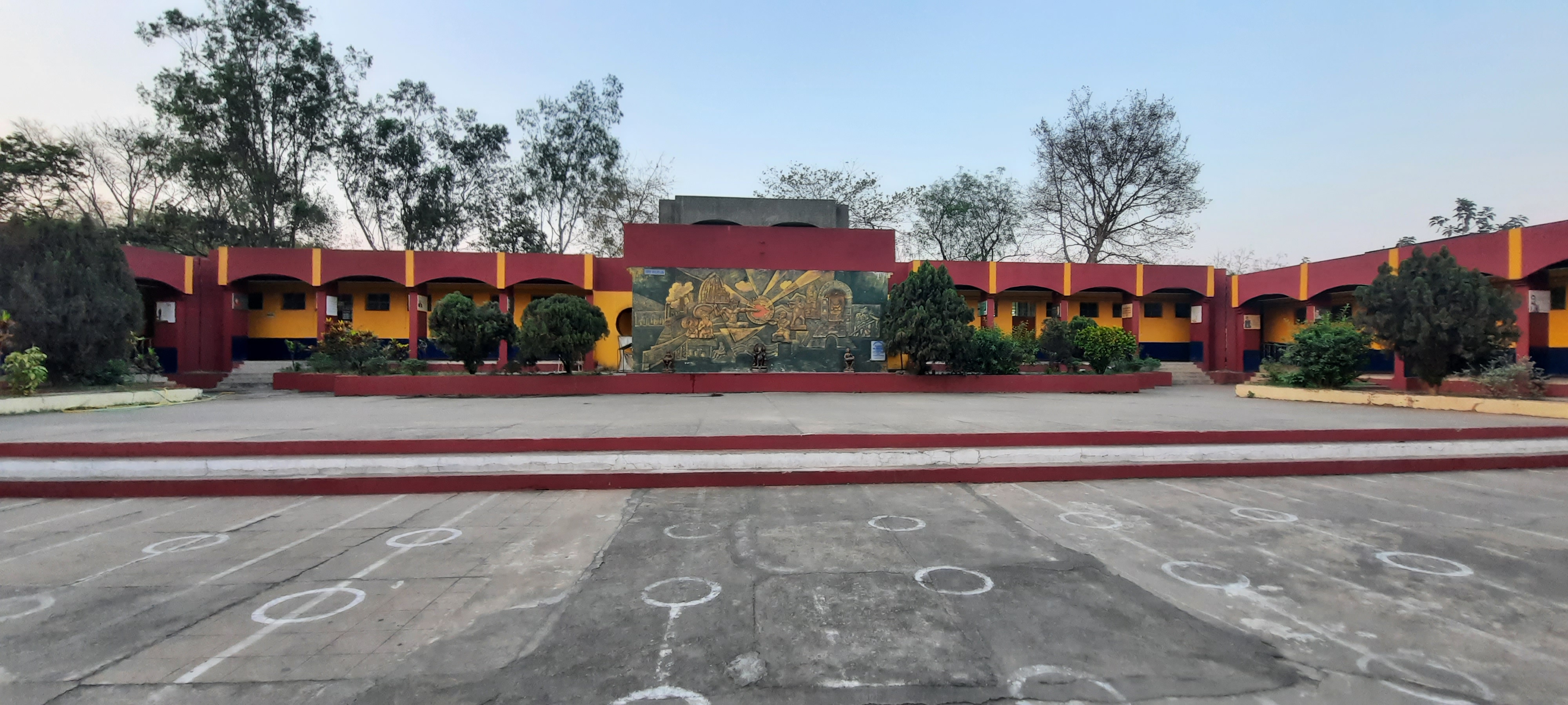
About JNV Dhenkanal
Jnv Dhenkanal. stated in the year 1986 temporarily at Rengali Dam site and subsequently shifted to its permanent site at Sarang in the year 1998
| 1. | Year of Establishment | 1986-87 at RENGALI dam site(temp. site) 1998 at SARANG (permanent site) |
||||||
| 2. | (i) | Complete address of the Vidyalaya with Pin code | Jawahar Navodaya Vidyalaya At/Po-Sarang, Via-IGIT Dist- Dhenkanal, Odisha, Pin-759146 |
|||||
| (ii) | Telegraphic Address | IGIT SARANG | ||||||
| (iii) | Telephone No, Fax No, with STD code | 06760-295622 | ||||||
| (iv) | E-mail ID | jnvdhenkanal@gmail.com | ||||||
| (v) | Website | https://navodaya.gov.in/nvs/nvs-school/Dhenkanal/en | ||||||
| 3. | (i) | Name of the Principal | Dr. Pratima Mishra | |||||
| (ii) | Name of the Vice Principal | Mrs. Namita Tripathy | ||||||
| 4. | Name of the Chairman, VMC, with complete postal address with PIN code Telephone No, Fax No, E-mail address and etc. | Sh. MANORANJAN MALLICK Collector & District Magistrate Dhenkanal . |
||||||
| 5. | Geographical Location of the Vidyalaya | |||||||
| (i) | Name of District Head Quarter & its distance from the Vidyalaya | Dhenkanal - 60km | ||||||
| Name of the state(Odisha) and its distance from state capital (Bhubaneswar) | 140km | |||||||
| (ii) | Climate condition of the District | Hot climate | ||||||
| (iii) | Name of nearest Railway station and its distance from the Vidyalaya | Talcher Road Railway station 10 km distance Talcher Railway station 12 Km. distance Talcher Thermal Railway station 5 km. distance |
||||||
| (iv) | Name of the nearest Bus Stand and its distance from the Vidyalaya | Talcher Busstand 7 km distance | ||||||
| (v) | Name of the nearest Air port and its distance from the Vidyalaya | Bhubaneswar –145 km | ||||||
| (vi) | Name of the Nearest Police Station and its distance from the Vidyalaya (please indicate the telephone no.) | Parjang –11 km Phone No.- |
||||||
| (vii) | Name the nearest Hospital and its distance from the Vidyalaya (please indicate the telephone no.) | Talcher – 7 km Tel.No. 06760-240226 Parjang -8k.m. Tel. No- |
||||||
| (viii) | Mode of Transport facility available to reach the Vidyalaya and its frequency | Bus and Train Transport upto Talcher | ||||||
| (ix) | Name of the nearest JNV and its distance from the Vidyalaya | JNV, Angul—22 km | ||||||
| (x) | Shortest route for reaching the Vidyalaya from Regional Office Bhopal (in Kms) (a) By Rail (b) By Road |
1. Bhopal to cuttack orBhubaneswar to Dhenkanal to Talcher Road or Talcher 2. Bhopal to sambalpur to Talcher Road or Talcher Distance from Bhubaneswar or cuttack Via Dhenkanal to Talcher -120km, Distance from Bhubaneswar-145km Distance from sambalpur-185km |
||||||
| (xi) | Shortest route for reaching the Vidyalaya from NVS (HQrs.) Delhi (in Kms) (a) By Rail (c) By Air |
From- New Delhi to Talcher To Bhubaneswar Air Port and from there by Bus Or Train |
||||||
| Geographical cond:- |
| Dhenkanal District is Occupying a Central position in the Geo-Political map of Odisha. It lies between 85°58' E to 86°2' E longitude and between 20°29' N 21°11' N latitude. It has a total area of 4452 Sq Kms. A population of 10,87,973 lives in this District. It is the District which touches the boundary of Keonjhar in the North, Jajpur in the East, Cuttack in the South and Angul in the West. The climate condition of the district is generally hot with high humidity during April and May and cold during December and January. The monsoon generally breaks during the month of June. Average annual rainfall of the District was 1741.5 m.m in 2005 which is higher than the normal rainfall (1421.1). |
| DHENKANAL ATTRACTION |
| The headquarters town of the district, Dhenkanal is ideally located on National Highway No. 55 connecting Cuttack with Sambalpur. It is commonly believed that the town is named after a ‘Savar Chief’ called ‘Dhenka’, who was in possession of a compact area around the present township. The town is clustered with the pinnacles of several temples dedicated to different deities of Hindu pantheon. Notable among them are the temples of Balabhadra, Sambhugopal, Raghunath and Kunajakanta Krishna. The unique collection of the District Museum here are traditional weapons of the ex-rulers of Dhenkanal and tools of the Paleolithic period. |
 |
| KAPILASH |
 The loftiest peak of Kapilash range enshrines the temple of Lord Shiva Chandrasekhar at height of about 457 meters. The place is identified with ‘Kailash’, the legendary abode of Lord Shiva. A flight of 1,351 steps and also a ghat road lead to the temple. Thousands of devout souls throng to Kapilash on the occasion of ‘Mahasivaratri’, the night consecrated to Lord Shiva in the month of February-March. To the east of the main temple at a higher altitude stands the temple of Narayan and Viswanath. The loftiest peak of Kapilash range enshrines the temple of Lord Shiva Chandrasekhar at height of about 457 meters. The place is identified with ‘Kailash’, the legendary abode of Lord Shiva. A flight of 1,351 steps and also a ghat road lead to the temple. Thousands of devout souls throng to Kapilash on the occasion of ‘Mahasivaratri’, the night consecrated to Lord Shiva in the month of February-March. To the east of the main temple at a higher altitude stands the temple of Narayan and Viswanath.The hill has several caves as well as the ruins of a mediaeval fort which are regularly visited by pilgrims. Some of the caves are associated with the Pauranic episodes that have great appeal to the visitors. The great names of Shridhar Swami, the celebrated commentator of the Bhagabat and Mahima Gosain, the founder of Mahima Cult, are historically associated with the place. Besides, the Deer Park and Science Park are two other added attractions of the place. |
| JORANDA |
 Famous as the religious headquarters of ‘Mahima Dharma’, Joranda houses the samadhi of Mahima Gosain, the preacherpropounder of the Mahima Cult, The other sacred temples are the ‘Sunya Mandira’, ‘Dhuni Mandira’ and ‘Gadi Mandira’ Pilgrims in large numbers pour forth to Joranda fair held on full-moon day of Magha which falls in January-February every year Famous as the religious headquarters of ‘Mahima Dharma’, Joranda houses the samadhi of Mahima Gosain, the preacherpropounder of the Mahima Cult, The other sacred temples are the ‘Sunya Mandira’, ‘Dhuni Mandira’ and ‘Gadi Mandira’ Pilgrims in large numbers pour forth to Joranda fair held on full-moon day of Magha which falls in January-February every year |
| SAPTASAJYA |
 A place of scenic beauty, Saptasahya is situated at a distance of about 11 km. To the south of Dhenkanal town. According to legend ‘Pandavas’ spent some days of their incognito life (Agnuata vasa) in these hills. The temple of Rafhunath built in honour of Lord Rama, Laxaman and Sita by Rani Ratnaprava Devi of Dhenkanal attracts large crowd every year on Ramanavami day in the month of March-April. A small spring flowing close by enhances the beauty of the place. It is an ideal place for picnic and relavation. A place of scenic beauty, Saptasahya is situated at a distance of about 11 km. To the south of Dhenkanal town. According to legend ‘Pandavas’ spent some days of their incognito life (Agnuata vasa) in these hills. The temple of Rafhunath built in honour of Lord Rama, Laxaman and Sita by Rani Ratnaprava Devi of Dhenkanal attracts large crowd every year on Ramanavami day in the month of March-April. A small spring flowing close by enhances the beauty of the place. It is an ideal place for picnic and relavation. |
| KUALO ASTHASAMBHU |
| 72 km. From Dhenkanal, 45 km from Angul and 25 km. From Talcher town, Kualo is famous for housing a plethora of temples dedicated to Lord Kanakeswar, Baidyanath, Paschimeswar, Balunkeswar and Kapileswar. In its ruined form, the temple of Kanakeswar is about 24 meters High and preserves some of the earliest specimens of sculptures representing temple building activities in Odisha |
| LADAGADA |
 40 km. From Dhenkanal town, Ladagada is a place of religious importance. A piece of stone known as Lord Siddheswar is worshipped here with great reverence. The banyan tree which gives shelter to the Lord is known as Kalpabruksha. 40 km. From Dhenkanal town, Ladagada is a place of religious importance. A piece of stone known as Lord Siddheswar is worshipped here with great reverence. The banyan tree which gives shelter to the Lord is known as Kalpabruksha. |
| SARANGA ANANTA SAYANA |
 67 km. From Dhenkanal,23 Km. From Angul and 3 km. From Talcher one finds the Anantasyi image of Lord Vishnu on the rocky bed of the river Brahmani at Saranga. The hoods of Ananta, the serpent king spread over the head of Lord Vishnu as the crown and cover. The primal lotus ,housing Brahma, the creator ,originates from Vishnu’s naval, the supreme being enjoys deep delight of his cosmic sleep in the water of the river Brahmani 67 km. From Dhenkanal,23 Km. From Angul and 3 km. From Talcher one finds the Anantasyi image of Lord Vishnu on the rocky bed of the river Brahmani at Saranga. The hoods of Ananta, the serpent king spread over the head of Lord Vishnu as the crown and cover. The primal lotus ,housing Brahma, the creator ,originates from Vishnu’s naval, the supreme being enjoys deep delight of his cosmic sleep in the water of the river Brahmani |
| DANDADHAR |
| 67 km. From Dhenkanal and 30 km. From Kamakshyanagar, Dandadhar is the site of an irrigation project on the river Ramial- an ideal place for outing. Blue expense of sparkling water caged in sun-bathed valley is a thrill to the searching eye |

Details about JNV Dhenkanal
| VIDYALAYA LAYOUT | |||||||||||||||||||||||||||||||||||||||||||||||||||||||||||||||||||||||||||||||||
|

