नवोदय विद्यालय समिति
Navodaya Vidyalaya Samiti
( An Autonomous Body Under Ministry of Education ) Government Of India
जवाहर नवोदय विद्यालय, ऊपरी सियांग(अरुणाचल प्रदेश)
Jawahar Navodaya Vidyalaya, Upper Siang(Ar. Pradesh)
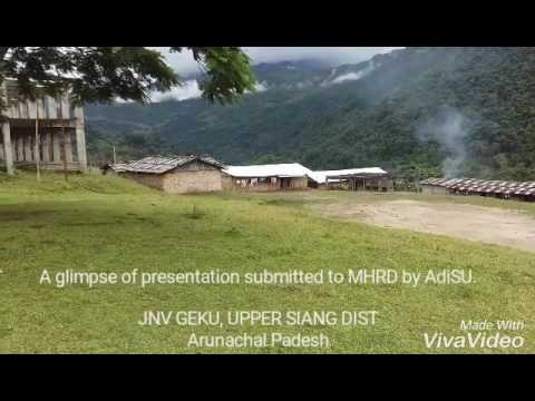
JNV UPPER SIANG
JNV upper siang is situated in the Village geku the District of Upeer Siang, Arunachal Pradesh.
The majority of the people are of the Adi tribe while the Memba, Khamba Idu Mishmi tribe also exist there (Idu Mishmi is not exist there). Part of the area was controlled by the Tibetan Kingdom of Powo when streams of Tibetan pilgrims searching for one of the 'hidden lands' or beyul (Standard Tibetan: sbas-yul) referred to in the prophecies of Guru Rinpoche in the East Himalayas from the mid-seventeenth century came south over the Doshong La pass, to seek the particular location of one of these earthly paradises called Padma bkod (written variously Pema köd, Pemakö and Pemako), literally 'Lotus Array' in the region. The region became administered by British India with the Simla Accord of 1914 and the demarkation of the McMahon Line, though China considers it part of South Tibet.
There are 7 plants in the district.[clarification needed] The district was formed in 1999 when it was split from East Siang district.[3]
Geography
The district headquarters are located at Yingkiong. Upper Siang district occupies an area of 6,118 square kilometres (2,362 sq mi),[4]
The district is the location of the massive Upper Siang Hydroelectric Project.
Transport
The 2,000-kilometre-long (1,200 mi) proposed Mago-Thingbu to Vijaynagar Arunachal Pradesh Frontier Highway along the McMahon Line,[5][6][7][8] (will intersect with the proposed East-West Industrial Corridor Highway) and will pass through this district, alignment map of which can be seen here and here.[9]
Divisions
There are two Arunachal Pradesh Legislative Assembly constituencies in this district: Tuting-Yingkiong and Mariyang-Geku. Both are part of Arunachal East Lok Sabha constituency.[10]
Demographics
| Historical population | ||
|---|---|---|
| Year | Pop. | ±% p.a. |
| 1961 | 9,790 | — |
| 1971 | 21,330 | +8.10% |
| 1981 | 21,125 | −0.10% |
| 1991 | 27,779 | +2.78% |
| 2001 | 33,363 | +1.85% |
| 2011 | 35,320 | +0.57% |
| source:[11] | ||
According to the 2011 census Upper Siang district has a population of 35,320,[12] roughly equal to the nation of Liechtenstein.[13] This gives it a ranking of 637th in India (out of a total of 640).[12] The district has a population density of 5 inhabitants per square kilometre (13/sq mi) .[12] Its population growth rate over the decade 2001–2011 was 5.77%.[12] Upper Siang has a sex ratio of 891 females for every 1000 males,[12] and a literacy rate of 59.94%.[12]
Various tribal groups of the Adi people and the Memba tribe live in the district. The Adi follow generally follow Donyi-Polo, and the Memba are followers of Tibetan Buddhism.
Languages
Languages spoken include Adi, a Sino-Tibetan tongue with approximately 140 000 speakers, and Tshangla and Khampa Tibetan languages both belonging to the Bodish group , these languages are written in both the Tibetan and Latin scripts.[14]
Flora and fauna
In 1986 Upper Siang district became home to Mouling National Park, which has an area of 483 km2 (186.5 sq mi).[15] A new mammal to science, Mebo giant flying squirrel (Petaurista siangensis) has been reported from this district[16]
Details about JNV Upper Siang
ABOUT JNV Uper Siang
- Place of Vidyalaya: Geku Village
- Name of District: Upper Siang
- Name of State: Arunachal Pradesh
- Year of Establishment: 2005
- Telephone and Fax No: 8794289480
- E-mail ID: jnvgeku24@gmail.com
- Name of the Commissioner: Bishwajit Kumar Singh, IFS
- Name of the Principal: B. R. MEENA
- Distance to Dist. HQs: 60 Km
- Nearest Town/Market: Yingkiong
- Nearest Bus Stand: Yingkiong
- Nearest Railway Station: Murkongselek
- Nearest Airport: Dibrugarh
- Extent of Land available: 22 ACRES